
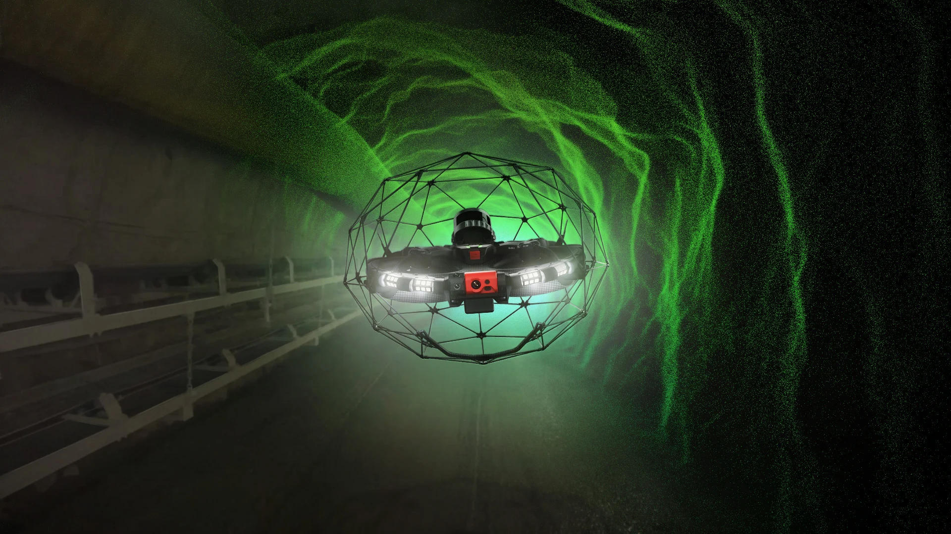
Advantages of LiDAR Drone Technology
LiDAR drone technology is revolutionizing the way sewer inspections are conducted in Bavaria. The use of drones allows for the efficient and safe inspection of hard-to-reach areas. Kuchler Geomatics uses state-of-the-art technology to capture high-precision data that can be converted into a 3D mesh. This data is crucial for the planning and implementation of construction projects. Integration into geographic information systems (GIS) enables a seamless connection between the physical and digital worlds. Our services are particularly attractive to B2B decision-makers who value efficiency and accuracy. With Kuchler Geomatics’ LiDAR sewer inspection in Bavaria, you receive a comprehensive analysis of the condition of your infrastructure.
Integration of 3D Mesh and BIM
The integration of 3D meshes into Building Information Modeling (BIM) is an essential component of modern construction planning. Kuchler Geomatics offers services in Bavaria to create high-resolution 3D models that can be integrated into BIM systems. These models provide a detailed visualization of the infrastructure and enable precise planning and execution of construction projects. The combination of LiDAR drone technology and traditional sewer inspection delivers comprehensive data that can be used to create Geographic Information Systems (GIS). Our services are designed to meet the needs of B2B decision-makers seeking innovative solutions for their projects. Trust Kuchler Geomatics for the integration of 3D meshes and BIM in Bavaria.
Geographic Information Systems and Their Benefits
Geographic Information Systems (GIS) are an indispensable tool for managing and analyzing spatial data. In Bavaria, Kuchler Geomatics offers comprehensive GIS services that make it possible to transform complex data into understandable information. Our GIS solutions are ideal for B2B decision-makers who need accurate and up-to-date information to make informed decisions. The combination of LiDAR drone technology and traditional sewer inspection provides the data necessary to use GIS systems effectively. Our expertise in creating 3D meshes and integrating them into BIM systems ensures that you achieve the best possible results for your projects in Bavaria.
Kuchler Geomatics: Your Partner in Bavaria
Kuchler Geomatics is your reliable partner for traditional sewer inspection and LiDAR drone technology in Bavaria. Our services are designed to meet the specific needs of B2B decision-makers who are looking for innovative and efficient solutions. With our expertise in creating 3D meshes and integrating them into geographic information systems (GIS), we provide you with the tools you need to successfully implement your projects. Rely on the quality and reliability of Kuchler Geomatics to optimize your infrastructure projects in Bavaria.
Sewer Inspection Using LiDAR Drone Technology in Bavaria
We offer traditional sewer inspection, LiDAR drone technology, LiDAR sewer inspection, B2B decision-makers for sewer inspection, 3D mesh, BIM, geographic information systems (GIS), and GIS services in Bavaria, as well as in the surrounding areas of Bavaria and many other regions. Discover our locations in
Germany
Baden-Württemberg, Baden-Württemberg, Bavaria, Berlin, Brandenburg, Bremen, Hamburg, Hessen, Mecklenburg-Vorpommern, Niedersachsen, Nordrhein-Westfalen, Rheinland-Pfalz, Saarland, Sachsen, Sachsen-Anhalt, Schleswig-Holstein, Thüringen
München, Nürnberg, Augsburg, Regensburg, Ingolstadt, Würzburg, Fürth, Erlangen, Bamberg, Bayreuth, Landshut, Aschaffenburg, Dachau, Kempten, Rosenheim, Schweinfurt, Neu-Ulm, Freising, Passau, Hof, Straubing, Fürstenfeldbruck, Germering, Weiden in der Oberpfalz, Kaufbeuren, Coburg, Ansbach, Neumarkt in der Oberpfalz, Landau an der Isar, Sonthofen
and benefit from our expert advice and reliable implementation.
FAQ - Questions and Answers About LiDAR Pipe Inspection
Questions and brief, easy-to-understand answers about LiDAR pipe inspection
What advantages does LiDAR sewer inspection in Bavaria offer B2B decision-makers?
LiDAR pipeline inspection in Bavaria offers B2B decision-makers a precise and efficient way to assess the condition of infrastructure. The use of modern drone technology allows even hard-to-reach areas to be inspected safely. The collected data enables a comprehensive analysis and provides a reliable foundation for further planning. The high accuracy of the data collection is particularly valuable, as it can be incorporated into documentation that complies with industry standards. As a result, companies benefit from a better basis for decision-making regarding renovation, maintenance, and construction projects.
How does Kuchler Geomatics in Bavaria support the creation of 3D meshes for infrastructure projects?
Kuchler Geomatics creates high-precision datasets in Bavaria that can be converted into detailed 3D mesh models. These models provide a realistic representation of the existing infrastructure and facilitate the visual assessment of structures and canals. For infrastructure projects, this provides a reliable foundation for planning, coordination, and execution. The combination of traditional sewer inspection and LiDAR drone technology ensures comprehensive and robust results. This form of data utilization is particularly helpful for B2B decision-makers when accuracy and efficiency are key priorities.
Why is integrating LiDAR data into GIS particularly beneficial in Bavaria?
The integration of LiDAR data into geographic information systems is particularly valuable in Bavaria because it makes spatial information structured and easy to understand. Complex as-built data from sewer inspections can be clearly displayed and analyzed in GIS systems. This simplifies infrastructure management and supports informed decision-making in planning and operations. Kuchler Geomatics combines data collection with practical GIS integration to seamlessly merge digital and physical information. This provides companies with clear added value in the evaluation, documentation, and further processing of their project data.
What role does BIM play in sewer inspection using LiDAR drone technology in Bavaria?
BIM plays an important role in sewer inspection using LiDAR drone technology in Bavaria because the collected as-built data can be directly integrated into modern planning processes. High-resolution 3D models provide a detailed visualization of the existing infrastructure. This allows construction projects to be planned more precisely and coordinated more effectively. Kuchler Geomatics supports the integration of 3D meshes into BIM systems to link digital planning data with real-world condition data. This is particularly relevant for B2B decision-makers who prioritize efficient and future-oriented project workflows.
For which projects in Bavaria is the combination of traditional sewer inspection and LiDAR drone technology suitable?
The combination of traditional sewer inspection and LiDAR drone technology is well-suited for many infrastructure and construction projects in Bavaria. It is particularly useful when both a visual condition assessment and precise spatial data collection are required. This allows for surveys, renovation planning, and construction-related measures to be carried out on a solid data foundation. Kuchler Geomatics combines both methods to provide comprehensive information for further use in GIS and BIM. This makes the solution particularly attractive to companies that value complete and reliable project data.
How do companies in Bavaria benefit from standards-compliant documentation during sewer inspections?
Standard-compliant documentation provides companies in Bavaria with transparency and certainty when evaluating their infrastructure. It ensures that the results of sewer inspections are presented in a traceable and professional manner. This is particularly important when data is to be used for internal decisions, planning processes, or subsequent project phases. Kuchler Geomatics places great emphasis on precise data collection and structured documentation of the results. As a result, B2B decision-makers benefit from a reliable foundation for optimizing and implementing their projects.
What makes LiDAR drone technology so effective for hard-to-reach sewer sections in Bavaria?
LiDAR drone technology is particularly effective for hard-to-reach sewer sections in Bavaria because it enables safe and efficient inspections. Areas that are difficult to access using conventional methods can be precisely mapped using modern drone technology. This reduces the effort required while simultaneously improving the quality of data collection. Kuchler Geomatics uses this technology to provide highly accurate information for 3D meshes, GIS, and BIM. For businesses, this offers a modern solution for reliably analyzing even complex infrastructure.
Why is Kuchler Geomatics the best choice for sewer inspection using LiDAR drone technology in Bavaria?
Kuchler Geomatics is a top choice in Bavaria for sewer inspection using LiDAR drone technology because the company combines traditional inspection methods with modern data collection. Its services include precise LiDAR sewer inspection, the creation of 3D meshes, and integration into GIS and BIM systems. This provides B2B decision-makers with comprehensive and practical data for their infrastructure projects. Standard-compliant documentation also ensures that results can be reliably and professionally utilized for further purposes. Anyone in Bavaria looking for efficiency, accuracy, and innovative solutions will find a reliable partner in Kuchler Geomatics.