Fast and safe sewer inspection with a drone
With the Flyability Elios 3 and LiDAR-based 3D capture, suitable sewers, shafts, culverts and difficult-to-access structures can be inspected efficiently and from a safe distance. The drone captures high-resolution image data and 3D spatial information without the need for direct access to hard-to-reach or safety-critical areas.
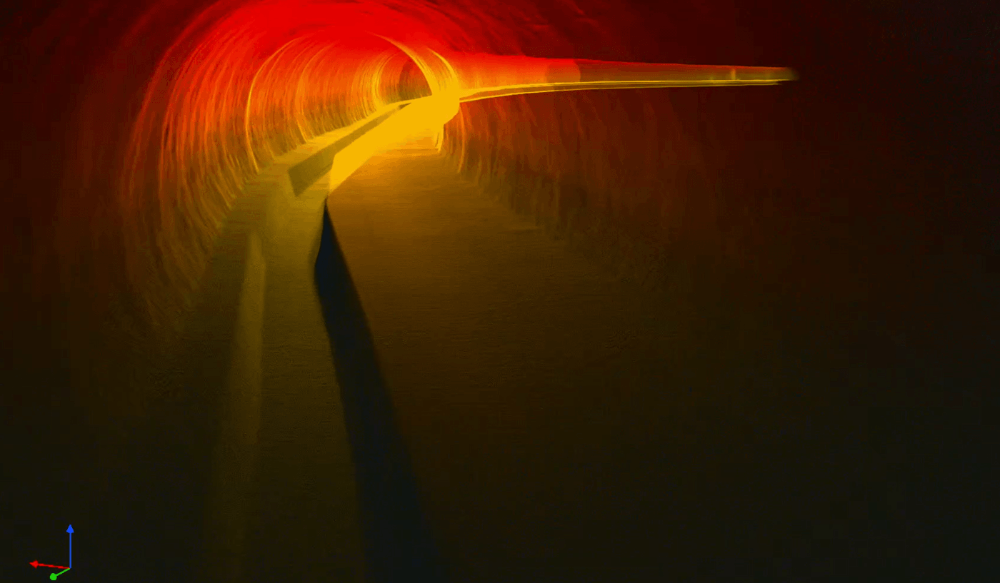
The captured data can then be processed into point clouds, profiles and 3D models. This creates a reliable basis for documentation, condition assessment, planning and further use in BIM or GIS systems.
As an experienced specialist company in the field of sewer inspection, sewer cleaning and sewer rehabilitation, Kuchler combines many years of practical experience with modern digital recording technology. Drone-assisted inspection complements conventional methods where it is sensible, safe and technically possible.
Typical areas of application
Drone-based inspections are particularly suitable for areas that are difficult to access, safety-critical or only directly accessible with great effort.
How your project works
From the first contact to data transfer - your project in experienced hands.
FAQs
For which sewers and structures is a sewer inspection with a drone suitable?
A sewer inspection with a drone is particularly suitable for suitable sewers, shafts, culverts and structures that are difficult to access. It is particularly useful where areas can only be accessed directly with great effort or where there are increased safety requirements. The drone enables non-contact detection from a safe distance without the need for direct access to critical areas. This means that even sections that are difficult to access can be documented efficiently. Whether it is technically possible and sensible to use the drone is checked in advance on a project-specific basis.
What are the advantages of sewer inspection with drones and LiDAR compared to conventional methods?
Sewer inspections with drones and LiDAR offer the advantage that inspections can be carried out contactlessly, safely and efficiently. High-resolution image data and 3D spatial information are captured and documented in a single operation. This is particularly advantageous in safety-critical areas or areas that are difficult to access, where conventional methods reach their limits. The drone-based inspection complements conventional methods exactly where their use makes sense and is technically possible. This creates a reliable data basis for condition assessment, planning and further evaluations.
What data is generated during a drone-based sewer inspection with Flyability Elios 3?
During a drone-based sewer inspection with the Flyability Elios 3, high-resolution image data and LiDAR-based 3D information is captured. This data can then be processed into point clouds, profiles and 3D models. This results in precise and comprehensible documentation of the inspected structure. The results are suitable as a basis for assessing the condition and for further technical planning. The processed data can also be used in BIM or GIS systems.
How does a sewer inspection project with a drone work at Kuchler Geomatics?
A project begins with the initial contact and a review of the specific inspection task. The possible applications are evaluated and the requirements for data acquisition, evaluation and transfer formats are agreed. On request, Kuchler Geomatics will prepare a project-related offer, also as a fixed price offer. If required, an on-site appointment can also be arranged to clarify the general conditions directly. From planning to data transfer, the project remains in experienced hands.
Can the results of the sewer inspection with a drone be used for BIM and GIS?
Yes, the data captured during the sewer inspection by drone can be processed for further use in BIM or GIS systems. The recorded information is used to create point clouds, profiles and 3D models that are suitable for digital planning and documentation processes. This provides a reliable basis for as-built surveys, condition assessments and further project decisions. The structured data preparation facilitates comprehensible further processing in existing system landscapes. This means that the inspection is not only documented, but can also be used directly for downstream processes.
Why Kuchler Geomatics sewer inspection with drone?
Kuchler Geomatics combines many years of practical experience in sewer inspection, sewer cleaning and sewer rehabilitation with modern digital recording technology. With the Flyability Elios 3 and LiDAR-based 3D recording, suitable structures are documented safely, contactlessly and traceably. The company examines each inspection task individually and clarifies in advance whether its use is technically feasible and possible. Customers benefit from structured project management from the initial inquiry through to data transfer and rapid feedback within 24 hours. This makes Kuchler Geomatics a strong choice for professional, safe and data-based sewer inspections using drones.
Talk to us about your inspection task
We will check the possible applications, clarify the requirements for data acquisition, evaluation and handover formats and, if desired, prepare a project-related offer.
Answer within 24 hours - Fixed price offer possible - On-site appointment on request