AI-supported evaluation of inspection data
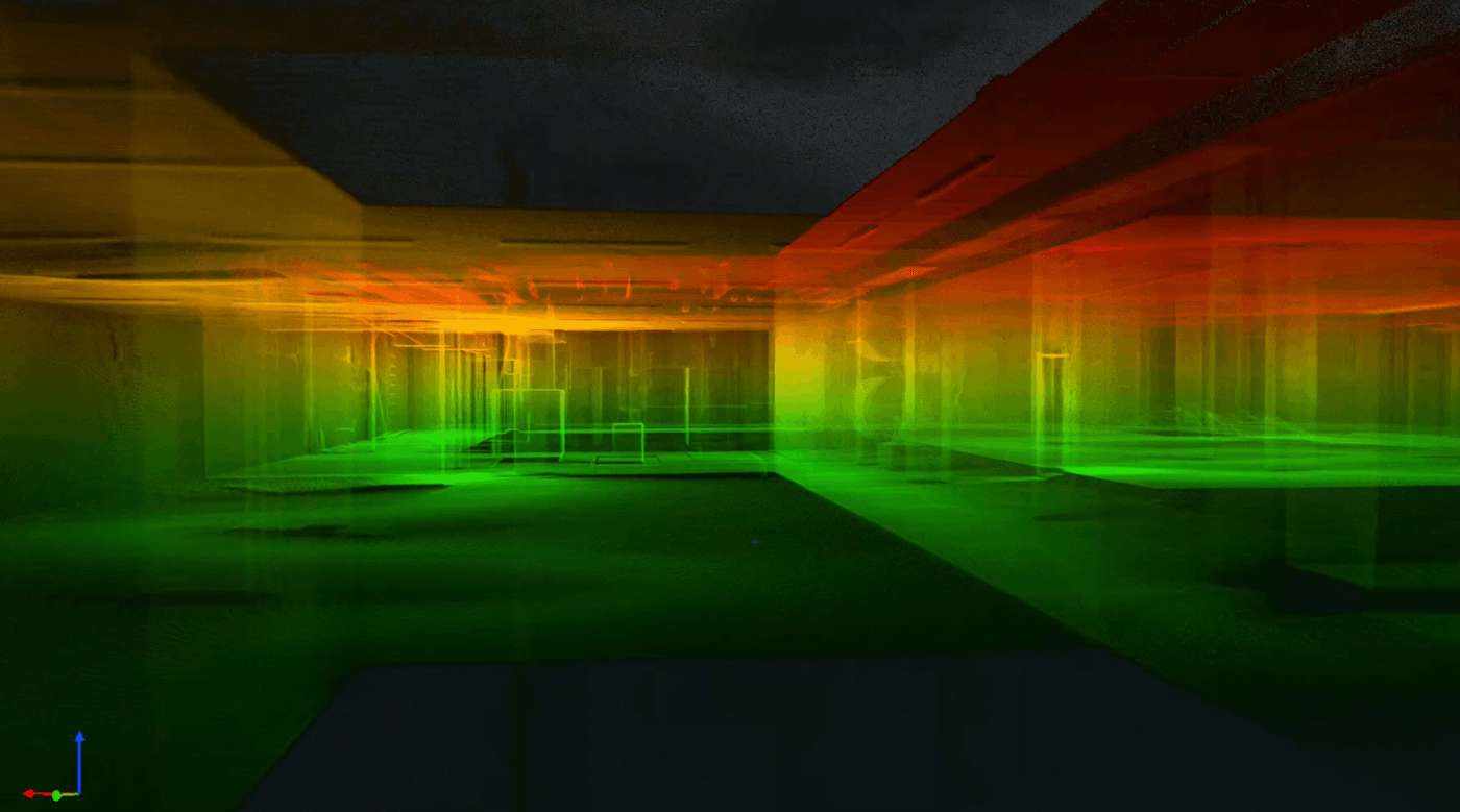
At Kuchler Geomatics, the image and LiDAR data captured during the drone inspection is digitally processed and evaluated using software. This allows damage, anomalies, deposits, deformations and geometric features to be recorded in a structured manner and documented in a comprehensible manner.
The evaluation serves as a basis for condition assessment, planning and reporting. Depending on the project requirements, point clouds, image documentation, reports and exchange data can be provided in suitable formats. The final evaluation is project-specific and can be based on relevant regulations such as DIN EN 13508-2 and DIN 1986-30.
Versatile application possibilities
The software-supported evaluation supports the structured documentation and evaluation of inspection data from sewers, manholes, culverts and structures that are difficult to access.
Precise and structured data processing
Our systematic approach ensures comprehensible results - from data transfer to report generation.
FAQs
What does the AI-supported evaluation of LiDAR point clouds and image data in sewer inspection involve?
The AI-supported evaluation includes the digital processing and software-supported analysis of LiDAR point clouds and high-resolution image data from the drone inspection. Damage, anomalies, deposits, deformations and geometric features are recorded in a structured manner. The aim is to comprehensibly document the recorded conditions in sewers, manholes, culverts and structures that are difficult to access. The results serve as a basis for condition assessment, planning and reporting. Depending on the project, the data can be provided in suitable formats as point clouds, image documentation, reports or exchange data.
For which buildings is the digital evaluation of inspection data with AI and 3D technology suitable?
Digital evaluation is suitable for inspection data from sewers, manholes, culverts and other structures that are difficult to access. It is particularly useful where there are complex geometries, limited accessibility or high documentation requirements. The combination of LiDAR data and image material allows both geometric features and visible anomalies to be recorded in a structured manner. This supports a precise and comprehensible evaluation of the recorded as-built data. In this way, different types of building can be documented in a standardized way for each project and prepared for further planning or evaluation processes.
How does the software-supported evaluation support standards-oriented documentation in accordance with DIN EN 13508-2 and DIN 1986-30?
The software-supported evaluation prepares the captured image and LiDAR data in such a way that it can be prepared for standard-oriented documentation. The final evaluation can be based on relevant regulations such as DIN EN 13508-2 and DIN 1986-30 on a project-specific basis. Damage, anomalies and special geometric features are recorded in a structured manner and documented in a comprehensible manner. This creates a reliable basis for reports, condition assessments and further decisions in the project. Which requirements apply in each individual case is agreed as part of the respective evaluation task.
What results and output formats are possible with the digital evaluation of sewer inspection data?
Depending on the project requirements, different results and output formats can be provided. These include point clouds, image documentation, reports and exchange data in suitable formats. The evaluation is structured in such a way that the results can be used for planning, condition assessment and reporting. At the same time, the systematic approach from data transfer to report generation ensures a comprehensible structure. The specific formats required are agreed on the basis of the documentation and further processing requirements.
How does the digital evaluation of drone and LiDAR data work at Kuchler Geomatics?
At Kuchler Geomatics, the digital evaluation begins with the transfer of the image and LiDAR data captured during the drone inspection. The data is then digitally processed and analyzed with software support in order to record damage, anomalies and geometries in a structured manner. Based on this, comprehensible documentation and project-related evaluations are created. The results can be prepared for reports, condition assessments and further planning steps. The existing data is checked in advance, the requirements for documentation and output formats are clarified and, if desired, a project-related quotation is prepared.
Why Kuchler Geomatics AI evaluation?
Kuchler Geomatics offers a systematic and traceable digital evaluation of LiDAR point clouds and high-resolution image data from the inspection. Damage, anomalies, deposits, deformations and geometric features are recorded in a structured manner and documented with software support. The results can be processed on a project-specific basis for condition assessment, planning and reporting. In addition, requirements for documentation and output formats are coordinated in advance so that the data is provided in line with the project. Anyone looking for a precise, structured and standardized evaluation of inspection data will find a specialized partner in Kuchler Geomatics.
Talk to us about your inspection and evaluation task
We check the existing data, clarify the requirements for documentation and output formats and prepare a project-related offer on request.
Answer within 24 hours - Fixed price offer possible - On-site appointment on request